Asset-level data makes utility vegetation management more dynamic and day-to-day risk more manageable. Here’s why the gap between regional weather data and structure-level conditions is the problem worth solving.
By Western Weather Group Editorial Team | In collaboration with R.M. Young Company
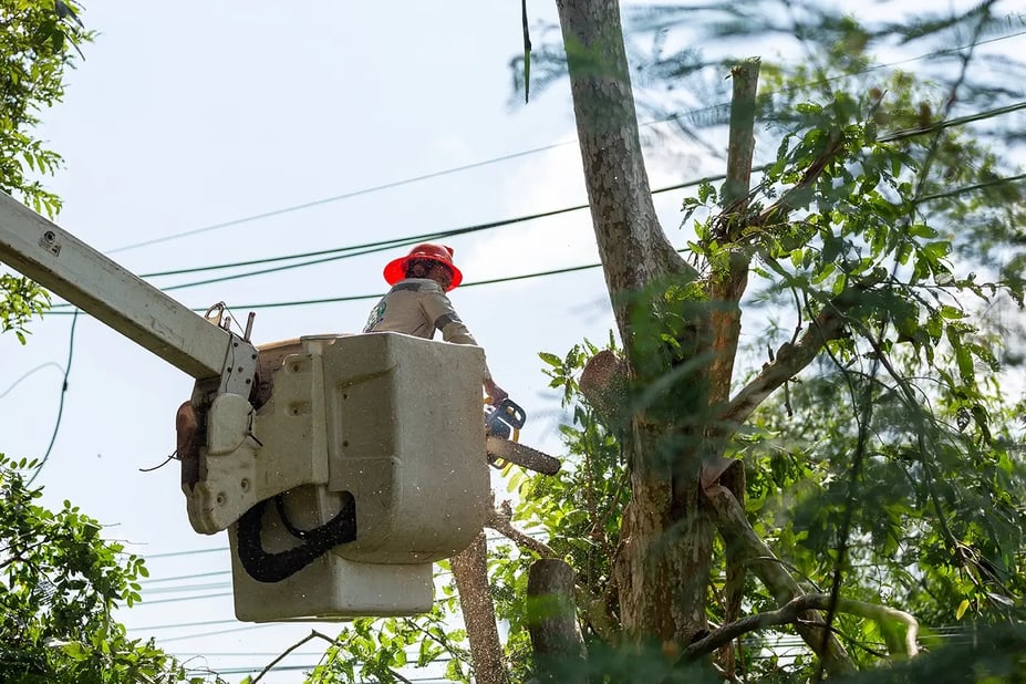
Power lines and trees have always been uneasy neighbors. Vegetation contact remains one of the leading causes of transmission and distribution outages across North America, with a CN Utility Consulting survey of 65 U.S. utilities finding that 23.2% of distribution outages are caused by vegetation. It's responsible for hundreds of millions of dollars in annual losses, regulatory penalties, and, in extreme cases, ignition events that become catastrophic wildfires.
The scale of the problem is reflected in what utilities spend to contain it: the power sector pours an estimated $6 to $8 billion a year into vegetation control, by Accenture's count, making it the single largest line item in most utilities' operating budgets. For decades, utilities have managed this risk through cyclical trim schedules and manual line patrols. What utilities have often lacked is a real-time view into the wind, loading, and other line conditions that ultimately drive branches into energized conductors.
Close enough isn’t close enough
Most utility vegetation management programs pull environmental data from the nearest available source: a regional airport ASOS station, a National Weather Service observation point, or a gridded forecast product. These are solid, reliable sources. They're just not your sources.
Transmission and distribution infrastructure operates line-segment by line-segment, span by span, through terrain that decides its own weather. A ridge-top corridor in complex mountain terrain routinely sees conditions that bear no resemblance to what's recorded at a valley-floor station eight miles away. Fast-moving, high-consequence wind events can develop along canyon-channeled lines without ever registering at a regional weather station. In practice, the gap between what meteorological infrastructure has historically provided and what line engineers and risk managers actually need has been filled by educated guesswork.
When the environmental inputs are off, everything downstream is off with them: conductor temperature, line sag, vegetation clearance risk, fire weather index. Garbage in, garbage out.
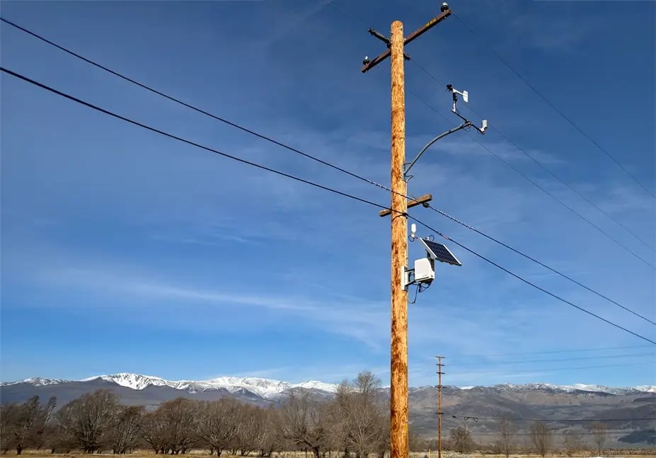
Structure-mounted sensing closes the gap
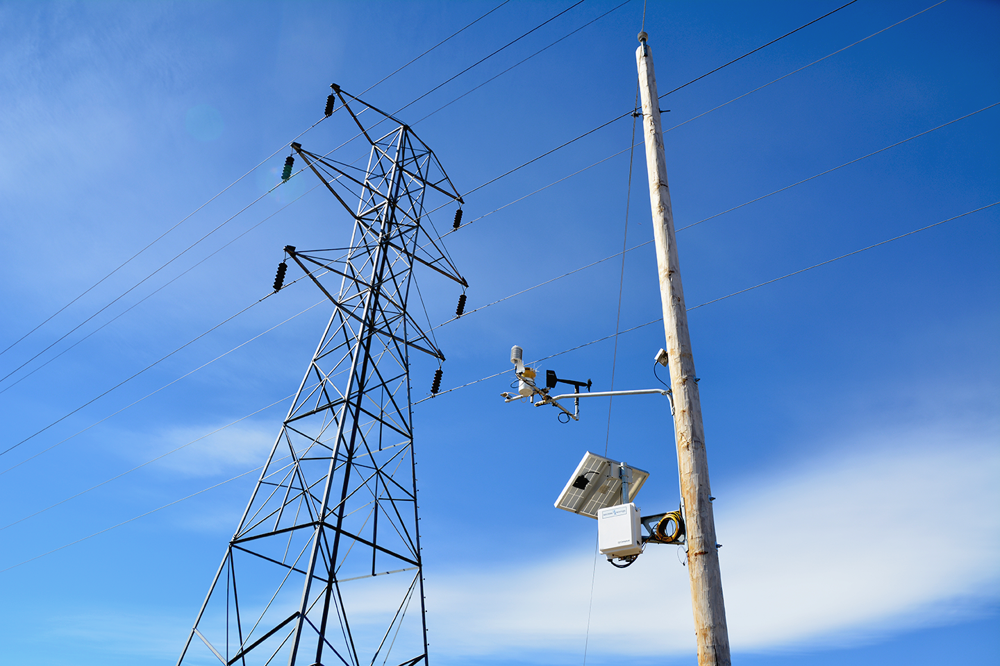
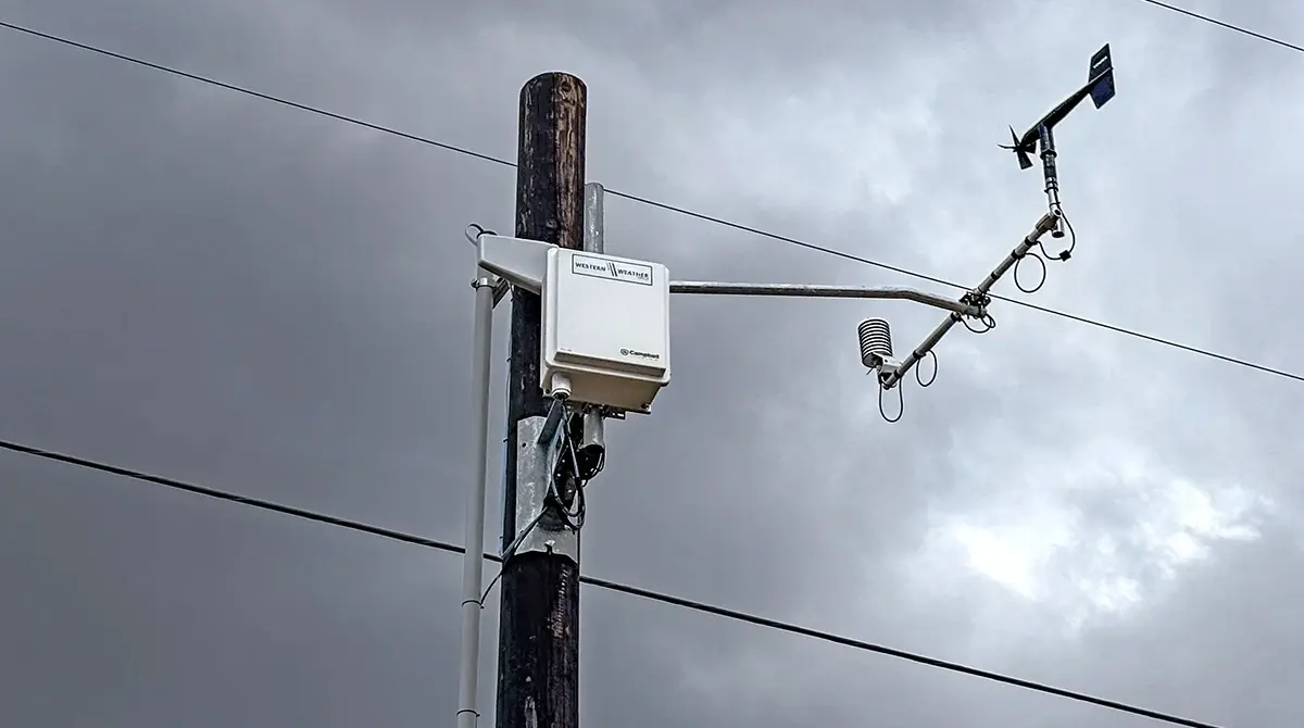
For decades, Western Weather Group (WWG) has mounted precision wind sensors built by R.M. Young Company directly on transmission towers, distribution poles, and substation structures. The result is a stream of hyperlocal, structure-level environmental data that feeds WWG's awareness platform alongside the third-party offerings utilities already rely on, turning what was once a retrospective maintenance problem into a dynamic, predictable risk signal.
The fundamental limitation of traditional vegetation risk management is spatial resolution. A gust that crests a forested ridgeline and accelerates into a transmission corridor registers in structure-mounted sensor data when and where it matters, rather than an interpolated estimate from a station several miles away. As one utility engineer put it: "The sensor is on the structure. The risk is on the structure. Those two things should be measured in the same place."
Wind speed and direction are the most consequential variables: localized gusts, direction shifts, and terrain-channeled acceleration can differ dramatically from regional observations.
But the full sensor picture goes further. Temperature and relative humidity drive conductor ratings and fuel-moisture conditions; solar radiation affects conductor temperature independently of air temperature; and precipitation records create a time-stamped log of exactly what happened at each structure.
Wind Measurement Technology: Choosing What Your Environment Demands
Not all wind sensors are equal in a utility environment. The right choice depends less on which technology sounds newer and more on what your application actually demands.
Mechanical anemometers and vane assemblies have served meteorology for over a century. That longevity exists for good reason: they're field-serviceable, calibration-verifiable, and built to measure high wind speeds accurately. When a bearing wears, it can be replaced in minutes with a standard tool. When calibration is questioned, it can be confirmed on-site with the right accessories. For utility vegetation management applications, where data integrity and instrument uptime are non-negotiable, that serviceability has real operational value.
Ultrasonic anemometers take a different approach. Using paired transducers to measure the time-of-flight difference of sound pulses traveling with and against the wind, they derive speed and direction with no rotating parts and no mechanical wear surfaces. That matters in two specific scenarios where mechanical sensors have limitations: measuring very low wind speeds (down to 0.01 meters per second, compared to 1 meter per second for a standard mechanical anemometer) and capturing rapid changes in wind velocity that a rotating sensor, slowed by inertia, may lag behind.
The tradeoff is worth understanding clearly. Ultrasonic sensors can't be calibrated or verified in the field. If something goes wrong, whether debris blocks the acoustic path, a bird impact bends a transducer post, or moisture compromises the electronics, there's no field fix. The sensor has to come out. For remote right-of-way installations where access is costly, that's a meaningful operational consideration.
For vegetation risk applications specifically, the ultrasonic advantage on update rate and low-speed sensitivity tips the balance. Peak gust events, the instantaneous conditions most likely to push a tree limb across a minimum approach distance, are fleeting. A sensor averaging over 60 seconds will miss the gust that causes a flashover. R.M. Young ultrasonic anemometers reporting at sub-second intervals let WWG's algorithms detect these transient events in time to be operationally useful.
Creating a defensible record
The value of asset-level sensing extends well beyond the operational decision it supports. Utilities in high fire-risk areas face mounting regulatory scrutiny, and they need evidence, not assertions, that their vegetation management programs actually work. A calibrated, time-stamped sensor record paired with a documented risk model creates exactly that: an audit trail general weather service data can't produce. When a utility can show that its de-energization call on a given afternoon was triggered by a specific measured wind condition at a specific structure, that's defensible data, and it carries real weight in regulatory proceedings and liability disputes.
Insurance markets for utility wildfire liability are watching the same data closely. As the actuarial community builds more granular models of utility ignition risk, the ability to document continuous structure-level wind monitoring becomes a differentiator in coverage terms.
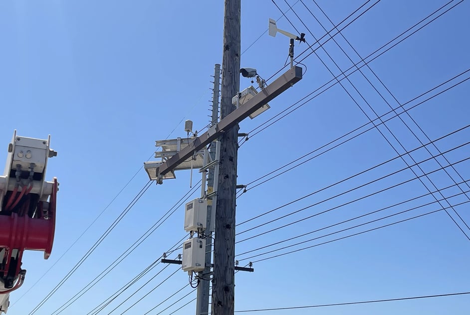
Better inputs, better everything
Vegetation management is fundamentally about managing uncertainty. The next offshore wind event will come on its own schedule, and humidity will drop to critical levels when it drops, often with little warning. Better data doesn't erase that uncertainty, but it narrows it considerably, and at scale. That matters.
Asset-level sensing isn't a replacement for sound practice, experienced crews, or well-designed inspection programs. It's the data foundation that makes all of them work better. The depth R.M. Young brings to the precise physical measurement of atmospheric motion and the depth WWG brings to translating that data into decisions that critical-infrastructure operators can act on are distinct and complementary.
When the inputs are right, the decisions are right. And in this line of work, the right decisions are the only kind that count.