Each year, fire season officially begins on May 1. For 2026, the numbers are already stark: as of April 30, nearly 1.85 million acres have burned across the country: 194% of the previous 10-year average, with 24,066 wildfires reported, 150% above average.1
For those of us tracking the atmospheric setup since early spring, the stats aren’t too surprising. These conditions have been building for months. Here’s the timeline and a region-by-region breakdown of how we got here, and what to expect as spring turns to summer.
March sets the stage
March didn't ease into fire season; it accelerated straight into it. Record daytime temperatures baked Northern California and the Southwest for days on end, sometimes stretching a full week without relief. Low pressure systems sliding through the Great Basin brought strong north winds that compounded the heat, stripping moisture from fine fuels at a pace that stood out even against historical benchmarks.
The result was an intense, rapid drying of grasses and brush across both regions that set the table for everything that's followed. Those effects haven't faded, and they're still driving conditions on the ground today.
April offered a window of respite, but closed it fast
April delivered a brief, but expected pause. A persistent troughing pattern kept fire risk in check through much of the month, and dead fuel moisture values trended near normal in many areas, with periodic rain providing some recovery after March’s record dryness.2 That was the good news.
The second half of April told a different story. Fire activity peaked, particularly across southern states (Texas, Oklahoma, Arkansas, Louisiana, Mississippi, Tennessee, Kentucky, and portions of neighboring states). Drought spread rapidly, nearing 62%, with extreme drought covering more than 19% of the country.1 The West, High Plains, and Southeast all saw drought develop or intensify throughout the month.
Snowpack across the West is also well below normal: many river basins from Oregon and California to the Great Basin and Southwest are at less than 20% from normal,1 with some basins already completely bare. That deficit matters: it means there’s less meltwater moderating fuel moisture heading into summer.
Region by region: where the risk is building

Northern California: more fuel, less relief?
NorCal faces a compounding dynamic this season. The rainfall that arrived following some exceptional heat is likely stimulating growth of fine fuels like grasses and brush. This might seem counterintuitive, but more fuel growth now means more dry, ignitable material later. As those fuels inevitably dry out through late spring into early summer, conditions become increasingly favorable for fire starts.
Significant fire potential is expected to remain near normal in May, supported by spring green-up and lingering snowmelt. By June, however, above-normal fire potential is forecast across much of Northern California1 as curing accelerates in the low and mid elevations. A grass fire activity uptick that is normally more typical of May was already observed in April across Central and Southern California,2 signaling how early the fire season transition arrived this year.
It’s also worth noting that Northern California does not benefit from monsoon season the way the Desert Southwest does. There is no late-summer moisture relief forecasted for this region, meaning fire conditions are likely to intensify through the summer without interruption.

The Southwest is dry; monsoon season is the wildcard
The Southwest experienced the same March heat and drying pattern as NorCal, and above normal significant fire potential is forecast through May, expanding into the Greater Four Corners and portions of southern Nevada by June. The lack of snowpack in Utah and Nevada means fuels will dry out faster than normal once warmer, drier weather resumes.1
On the monsoon front; the key relief variable for this region; there is cautiously good news. The latest NIFC outlook suggests an above normal monsoon season is possible in the Southwest.1 That’s a more optimistic signal than we had in early spring, though the timing and strength remain uncertain. How early and robust that monsoon develops will shape the back half of fire season significantly.

The South went from quiet to crisis in weeks
This is where the situation has shifted most dramatically. In early April, the relative quiet across Florida and Southern Georgia was notable, even surprising, given how severe the drought had become. But that didn’t last.
Mid-April brought extreme fire behavior to South Georgia. Multiple large fires emerged, with the Highway 82 and Pineland Road fires destroying dozens of homes and prompting a state of emergency across more than half of Georgia's counties.3 Both fires have since reached 90% containment following a period of wetter weather in early May, and the statewide burn ban and state of emergency was lifted, though recovery operations continue across 17 counties.4 The Florida Panhandle saw less than 20% of normal precipitation in April among the most severe precipitation deficits anywhere in the country,1 and elevated fire risk persists statewide, with new fires still active.3
Above normal significant fire potential is forecast to persist through May across the coastal Southeast, far southern Alabama, and Florida. In June, that footprint retreats to South Georgia and Florida, with normal potential returning to the broader coastal Southeast; however, above normal potential is simultaneously forecast to expand into east Texas and most of Louisiana. The monsoon remains the primary long-range relief mechanism for Florida and South Georgia, with the peak window falling in June and July.1

The Pacific Northwest looks green now, but summer is another story
The Northwest’s new vegetation growth is currently keeping the fire potential in check through May, but the setup for summer isn’t as reassuring. April was warm and dry across much of Oregon and Washington; mid-elevation snowpack has melted out earlier than usual, and drought has persisted across eastern Oregon and central-to-southeastern Washington. NIFC projects the first broad step-up in significant fire potential east of the Cascades by June, with above normal potential expanding westward and northward through July and August.1
El Niño has entered the forecast
A climate factor that wasn’t part of the early April conversation has moved to the front of the forecast: El Niño. The El Niño-Southern Oscillation (ENSO) has transitioned to a neutral state, but sea surface temperatures in the central and eastern Pacific are warming rapidly, with subsurface temperatures running more than 5°C above normal east of the International Date Line.1
The Climate Prediction Center now puts the probability of El Niño conditions developing this month into June and July at 62%, rising to near 90% by late summer.1 A strong or very strong El Niño by fall and winter is on the table. For fire season, the relevance is clear: El Niño summers tend to amplify heat and dryness across the West. Should typical El Niño effects materialize, they would compound the concerning fire conditions already established this spring with the Northwest and Northern Rockies facing the most significant exposure in the July–August period.
How we’re supporting clients this season, and every season
This year, we began issuing heat-related forecasts to clients roughly two months earlier than usual. That early start was validated by conditions in March and April, and reflects a broader shift in how clients are approaching fire and heat risk: planning earlier and acting more proactively.
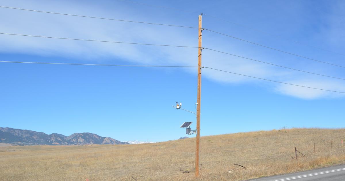
Building on that momentum, multiple clients across the utility and agriculture spaces are asking to expand the geographic reach of both their fire weather and heat-related forecast coverage, including on-demand forecasts when the fire danger risk is very high. We're actively building out that coverage as the season develops. For utilities weighing shutoff decisions, that coverage pairs purpose-built weather station networks with real-time weather monitoring tuned to local fire-weather thresholds.
Sources
-
NIFC National Significant Wildland Fire Potential Outlook, May 1, 2026. nifc.gov
-
NIFC South Ops Monthly/Seasonal Outlook, April 30, 2026. gacc.nifc.gov
-
NIFC Incident Management Situation Report, May 14, 2026. nifc.gov
-
Georgia Forestry Commission, Current Wildfire Information and Resources. gatrees.org
Western Weather Group provides specialized weather forecasting for utilities, grid operators, and industries operating in high-risk weather environments.