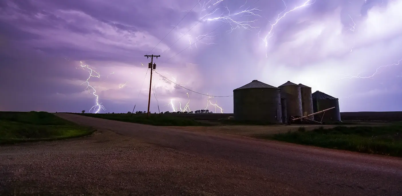
Regional forecasts tell you what's coming. Ground truth tells you what's happening. The difference can cost billions.

Drawing on industry expertise from Jeff Gawrych, Utility Solutions Advisor at WWG, this article examines why asset-level weather data is rapidly becoming essential infrastructure for operational decision-making.
For years, many electric utilities operated under a straightforward assumption: weather intelligence was something you purchased, not something you built.
Regional forecast models were improving. Third-party analytics platforms promised operational insight without the expense and complexity of deploying physical sensor networks.
For most utilities, that seemed sufficient. And for a while, it was.
But the major storms, wildfires, and grid failures of the past decade have forced a fundamental reassessment. Weather stations, once viewed as regulatory overhead or niche research tools, are now being recognized as critical infrastructure. The shift from weather consumers to data owners is reshaping how modern utilities manage risk, protect assets, and make operational decisions.
The 2010s: An Era of “Good Enough” Data
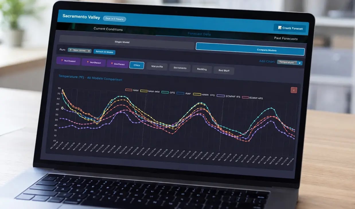
Through much of the 2010s, utilities leaned heavily into commercial weather providers, National Weather Service products, and increasingly sophisticated numerical forecast models. Operational teams monitored storms through dashboards, outage analysts ran prediction models built on regional guidance, and risk teams assessed wildfire potential from county-level weather products.
Hardware investments were uncommon unless regulations required it. Most stakeholders believed interpolated model data was accurate enough to reflect real-world conditions for everyday operational decisions. When the question of installing additional sensors came up, they were usually seen as too costly for the value they provided.
This approach made sense at the time. Utilities operated under constant capital pressure, and investing in dense, on-site instrumentation was difficult to justify when software capabilities were rapidly improving. Many assumed that more advanced models and analytics could fill in the gaps left by limited observations.
That assumption has not held up.
What Extreme Weather Exposed
The limits of modeled weather data weren’t exposed through a single event. They emerged from a series of hard operational lessons repeated across multiple regions and over the years.
-1.png?width=1600&height=896&name=Untitled%20design%20(5)-1.png)
Hurricanes. Rainfall totals can vary dramatically across a single service territory. What registered as moderate precipitation at the regional forecast level could produce severe, localized flooding miles away from the nearest official observation point. After post-storm damage assessments, utilities often found that the conditions affecting specific assets looked very different from what the models had shown.
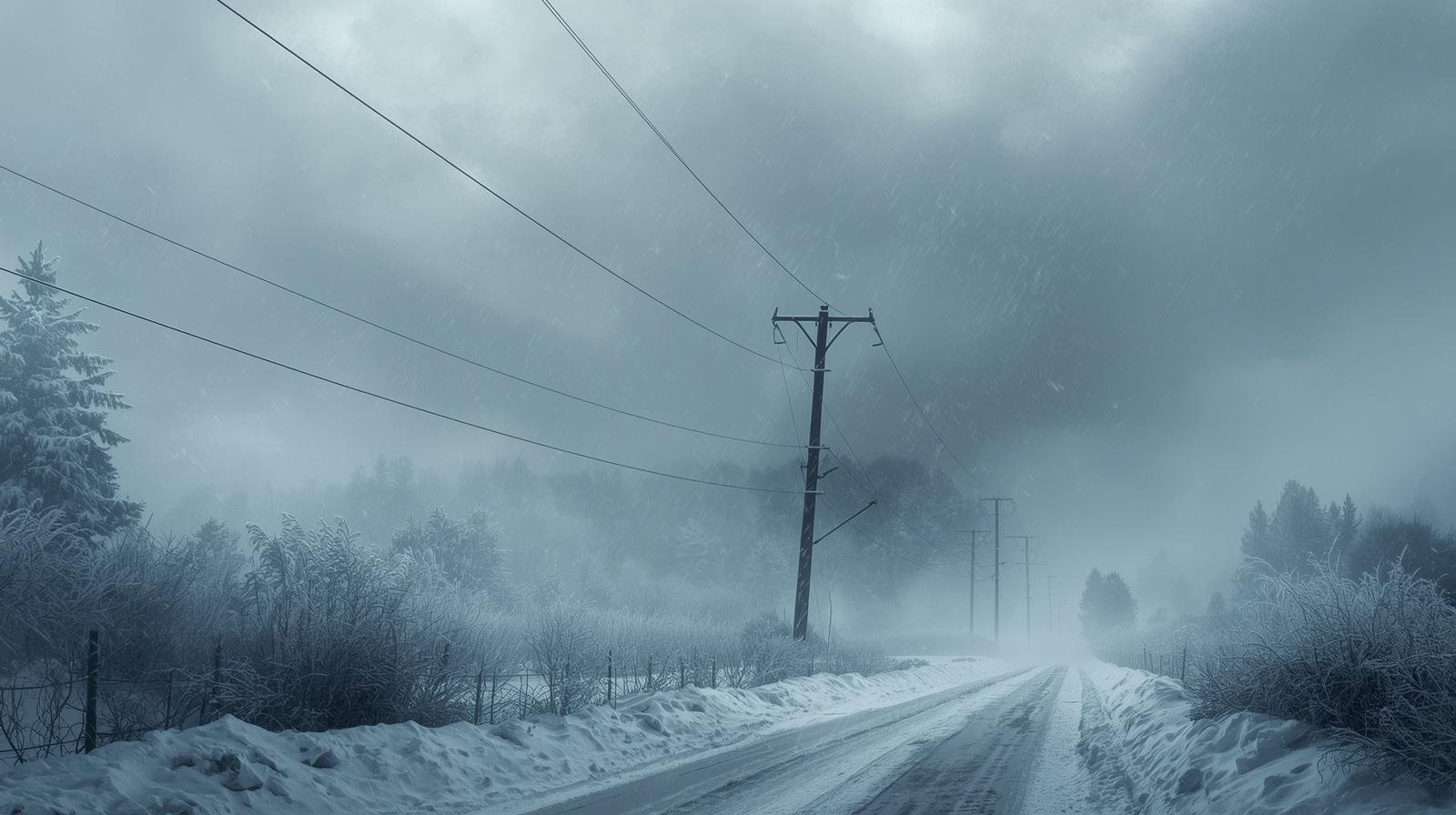
Winter storms. Ice accumulation and temperature drops that strain specific grid segments do not always follow the smooth geographic gradients that interpolation assumes. Wind chill, conductor icing, and equipment behavior in extreme cold depend on hyperlocal conditions that a regional airport observation simply cannot capture.
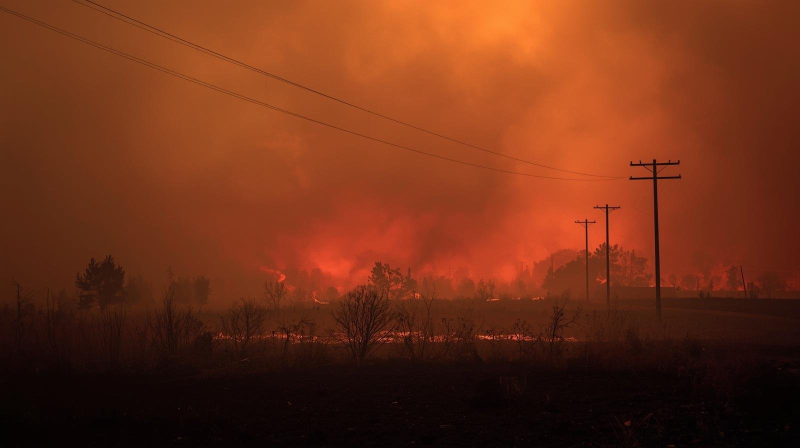
Wildfire seasons. These have been the most consequential teacher. Wind speed, relative humidity, and fuel moisture have become among the most operationally and legally significant variables a utility can measure. Public Safety Power Shutoff (PSPS) decisions, which can affect hundreds of thousands of customers at a time, hinge on these readings. Whether a shutoff is triggered can come down to a few miles per hour of wind at a specific location along a specific line.
According to NOAA, the United States averaged fewer than four billion-dollar weather and climate disasters per year in the 1980s. Over the past five years, that average has exceeded 20 per year. The financial exposure utilities face from extreme weather events has grown proportionally, and so has the scrutiny applied to their operational decisions in the aftermath.
The Fundamental Limits of Modeled Data
Modern weather models are remarkably sophisticated. Public and private weather providers now run ensemble forecasts at increasingly fine resolutions, and machine learning and emerging AI approaches are improving short-range accuracy in meaningful ways. But none of this eliminates the core problem facing utilities: models are only as good as the observations that anchor them.
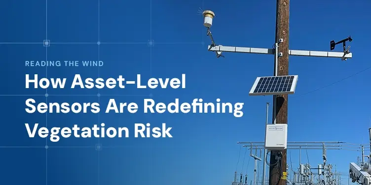
The official surface observation network in the United States, maintained primarily through the Automated Surface Observing System, was designed to serve aviation. Stations are sited to meet Federal Aviation Administration standards, meaning they are located at airports and calibrated for conditions relevant to flight operations. They are not sited to represent the conditions experienced by transmission lines crossing mountain ridges, substations in valley terrain, or distribution assets along coastal corridors.
Terrain-driven wind behavior illustrates the problem clearly. Wind speed and direction can vary by 50 percent or more across a ridge line within just a few hundred feet. On the relatively flat terrain where most official weather stations sit, those gradients are effectively invisible. For utilities operating infrastructure across complex terrain and topography, that invisibility translates directly into operational risk and causes real consequences.
Precipitation behaves virtually the same way. Orographic enhancement, coastal convergence zones, and urban heat effects can cause rainfall to vary dramatically over short distances. A gauge reading from an airport several miles away may have almost no relationship to what falls on a specific watershed or distribution circuit.
Temperature matters too, particularly for utilities operating dynamic line rating programs. The ampacity of a transmission conductor; meaning how much current it can safely carry; is sensitive to ambient temperature, wind speed, and solar radiation at the conductor itself. Dynamic line rating programs that use real-time environmental data to optimize capacity can increase available transmission by 10 to 40 percent compared to static ratings, according to research supported by the Department of Energy. But those gains depend entirely on the accuracy of local environmental observations. Substituting regional model estimates for direct measurements introduces uncertainty that erodes the program’s operational reliability and financial value.
Why Better Software Doesn’t Eliminate the Need for Better Hardware
A reasonable question arises: if AI and machine learning improve weather forecasting, will advances in software eventually reduce the need for physical weather sensors and instrumentation?
The answer, based on how these systems actually work, is no. In fact, advances in AI increase the need for high-quality, on-the-ground data.
Machine learning models used for outage prediction, wildfire risk assessment, and power grid optimization are trained on historical relationships between environmental conditions and outcomes. The accuracy of these models depends entirely on the quality and precision of the input data. When wind speeds come from airport-based weather station observations that are miles away, or temperature readings are interpolated across complex terrain, those inaccuracies become embedded in the model. In other words, poor data leads to unreliable predictions, especially when public safety is on the line.
Advanced analytics doesn’t reduce the need for better data, it amplifies it. As utilities rely more on AI-driven risk scores and automated decision-making, every underlying data error carries greater operational and financial consequences. Asset-level weather stations and localized sensors are not a replacement for advanced analytics, they are the foundation that makes those analytics reliable and trustworthy.
This shift is already changing how utilities invest in technology. Weather monitoring infrastructure and analytics platforms are increasingly deployed as integrated systems, not standalone tools, because the value of each depends directly on the quality of the other.
Ground Truth Changes the Legal and Regulatory Equation
Beyond operational performance, asset-level weather data carries significant value in regulatory proceedings, insurance claims, and legal disputes.
When a utility takes an action based on weather conditions; whether triggering a shutoff, delaying restoration, or curtailing load; regulators and courts want to understand what the utility knew and when it knew it. A direct observation from a station sited near the relevant asset is a fundamentally different category of evidence than an interpolated model output from a system designed for a different purpose.
Utilities that have built dense monitoring networks can reconstruct the environmental conditions at any point in their territory at any moment in time with a degree of precision that modeled data cannot match. That capability matters when an investigator asks what the wind speed was at a specific transmission line segment at the moment an ignition occurred. It matters when an insurer is assessing the reasonableness of an operational decision, and it matters when a regulator evaluates whether a utility met its obligation to respond to developing hazards.
On the other hand, utilities that relied on regional models and cannot provide asset-level documentation of the conditions they faced are in a weaker evidentiary position, regardless of whether their decisions were operationally sound. The data gap becomes a liability gap.
From Compliance Item to Core Infrastructure
The change in how leading utilities are thinking about weather monitoring is visible in how they are approaching procurement and planning. Weather stations are no longer being evaluated primarily as compliance line items. They are being incorporated into long-range infrastructure investment plans alongside transmission hardening, substation automation, and grid modernization programs.
Several interconnected needs are driving this shift:
- Wildfire mitigation plans required by regulators in western states increasingly specify monitoring density thresholds that exceed what any commercial data service can provide.
- Dynamic line rating and other advanced grid optimization programs require continuous, localized environmental inputs to deliver their promised benefits.
- Outage prediction models being deployed by utilities to improve storm response require training data and real-time inputs grounded in direct observation.
- Insurance and financing markets are beginning to ask utilities to demonstrate the quality of their situational awareness as a component of risk assessment.
The operational and financial case for asset-level monitoring has become clearer as the cost of extreme weather events has grown. Lawrence Berkeley National Laboratory has estimated the annual cost of power interruptions to U.S. electricity customers at over $150 billion. Extreme weather accounts for the majority of the costliest outage events. Investments that reduce the frequency or duration of weather-driven outages carry substantial measurable returns.
A New Standard for Grid Intelligence
The utilities that built early weather monitoring networks, often in response to specific catastrophic events, have demonstrated what is possible when operational decisions are grounded in direct environmental observation rather than modeled approximations. The question for the rest of the industry is no longer whether asset-level monitoring provides value, it’s how quickly the gap can be closed.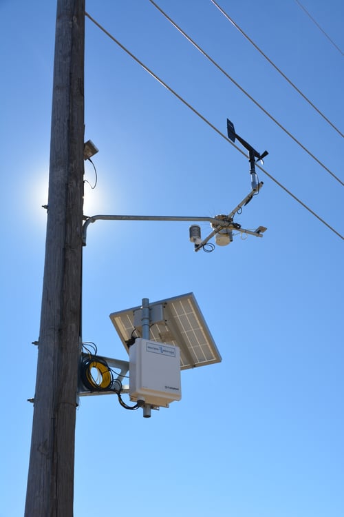
Regional forecasts and commercial data services remain important. They provide context and situational awareness across broad geographies that no sensor network can fully replicate. The question every utility must answer is whether that level of precision is sufficient for the decisions it is actually making.
For decisions involving wildfire risk, infrastructure loading, safety protocols, and significant financial exposure, regional data is not sufficient. The variables that determine outcomes at the asset level are measured in local conditions, not regional averages. And local conditions can only be known through local measurement.
A decade ago, weather was something utilities received. Today, the utilities best positioned to manage an increasingly volatile climate are the ones treating weather data as something they own, operate, and integrate into every layer of grid intelligence. That is not a technology preference, it’s an operational necessity.
When the stakes are high enough, precision stops being a nice-to-have. It becomes part of how you protect the grid, your customers, and your organization.